 Mile Marker TX
Your 10-20, to the tenth. Even out here.
Mile marker to the tenth, the road ahead and behind, city limits or county, and the nearest 911 address. One tap copies it all for the report. And it keeps working where the radio is the only thing with signal.
One tap. Report ready.
Copy for report puts everything a crash report or a radio call needs into one block. Paste it into the report, a text or your notes.
- Highway, mile marker to the tenth, and direction of travel
- The next road ahead and the last one behind, each with its distance
- County, and inside or outside city limits
- The nearest 911 address
- GPS in decimal degrees and in degrees, minutes and seconds
- The date and time
Highway · mile marker · direction
Ahead: next road, distance
Behind: last road, distance
County · inside or outside city limits
Nearest 911 address
GPS, decimal and DMS
Date and time
Check it against the posted signs. It's a starting point for your report, not an official record.
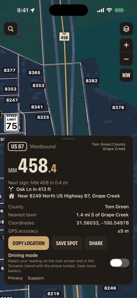
City or county? Know before you key up.
The card says whether you're inside city limits or out, which county you're in, and how close the county line is.
- "Inside San Angelo city limits" or "Tom Green County, outside city limits"
- "County line 0.4 mi W" as you get close to one
- City limits and county lines from the Texas Geographic Information Office
- Right on the card, under your road and mile marker
Boundaries are approximate. Confirm jurisdiction the way your agency does.
The history of a place, in one file.
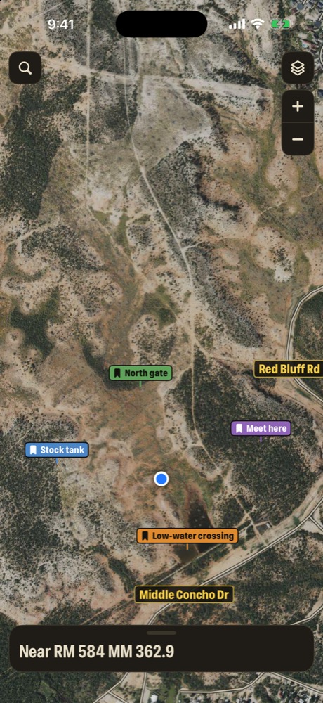
The gate cattle keep getting out of. The low-water crossing that floods. Drop a pin, and it keeps a running file every unit can add to.
- Address and a contact person at the top of the file
- Dated, time-stamped entries with photos and documents
- Entries can't be edited, only deleted, so the history stays straight
- Share the pin with your group and every unit adds to the same file, each entry signed with its writer's name
- Encrypted on the phone with your group code before it goes to iCloud. Apple and we can't read it
Mile Marker TX isn't a records management system and isn't CJIS certified. Keep criminal justice information out of it, and follow your agency's policy.
Every unit, on one map.
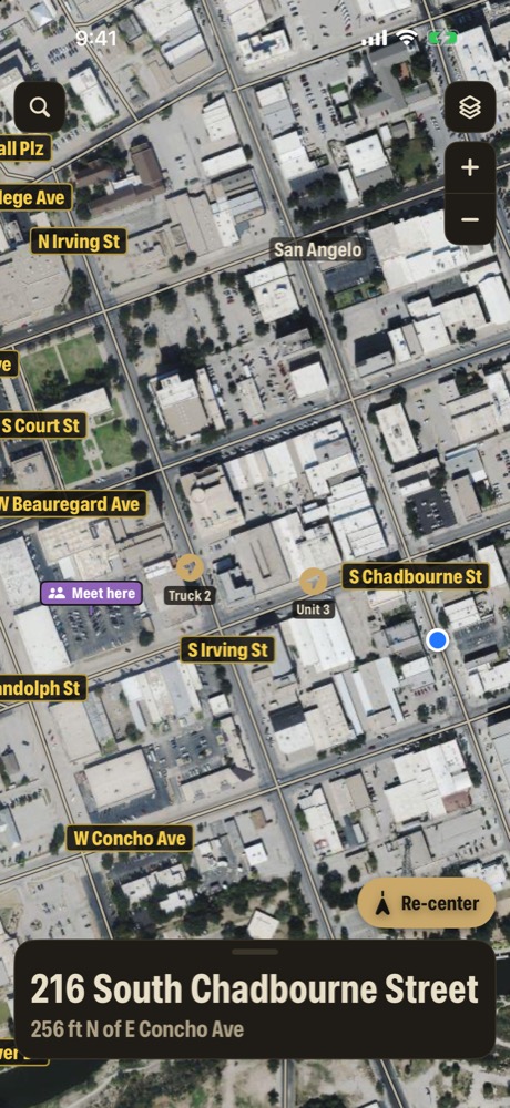
Spread across a county on a search, a perimeter or a flood night, everyone in your group shows on the same map.
- Join with a share code. Only a scrambled version of it is stored online
- Each phone shows the name you pick, like Unit 3
- Send a pin to one unit, or to the whole group
- Units show only while Share my location is on, with no location history
- Positions older than 15 minutes are hidden
Built for a dark cab.
Night mode dims the map and tints the card red when the sun goes down.
- Night mode: Off, On, or Auto at local sunset
- It dims the map and turns the card red, easy on night vision
- Driving mode keeps your road and mile marker on the lock screen and in the Dynamic Island
- Silent turn alerts and Apple Watch taps, so nothing talks over the radio
- "Hey Siri, where am I in Mile Marker TX" reads your location back
No signal. Still routes.
The calls that matter most come from where other map apps go blank.
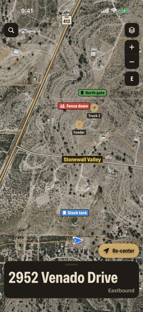
- Route me there works with no signal, onto ranch, lease and private roads
- Out past the pavement, the banner reminds you to check gates
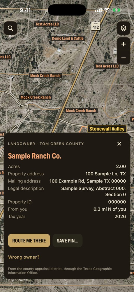
- The landowner on every tract, with a mailing address, for livestock out or a gate left open
- Breadcrumb trail: record where you've been and share it as a GPX file
- Coordinates in UTM and USNG/MGRS for search and rescue teams
Seeing land on the map gives no one permission to enter it. Many ranch tracks are private.
And the rest of it.
Every copy of Mile Marker TX has these too.
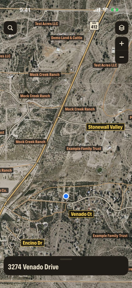
12.1 million 911 addresses
Search any house number and the map flies there, even with no signal.
Miles from the highway
On a county road, the miles back to the highway and that highway's mile marker.
Any coordinates
Decimal, DMS, UTM, USNG/MGRS or a map link, in one search box.
Turn alerts, no voice
A quiet alert before each turn and a tap on Apple Watch.
Breadcrumb trail
Record a trail on the phone and share it as GPX.
Is this an official law enforcement tool?
Mile Marker TX is made by Redstone Oak Investments LLC, a Texas company. It isn't affiliated with or endorsed by any law enforcement agency, TxDOT, or any other government agency. It doesn't dispatch, doesn't call 911, and doesn't replace your CAD, your agency's maps or your radio.
Can we put case information in pin files?
No. Mile Marker TX isn't a records management system and isn't CJIS certified. Use pin files for places: gates, crossings, landowner contacts, recurring problems with livestock or water. Keep criminal justice information, and anything about a person, out of it, and follow your agency's policy.
Who can see our units?
Only phones that enter the same share code, and only while each person has Share my location on. There's no location history, and positions older than 15 minutes are hidden.
Does it work with no signal?
Mile marker readings, 911 addresses, landowners, the offline map and offline routes all work with no signal. Satellite view and group updates need signal.
How accurate are the mile marker and the city limits?
Whole markers come from TxDOT's posted sign locations, and tenths are measured along the road between them. City limits and county lines come from the Texas Geographic Information Office and are approximate. Check the posted signs, and confirm jurisdiction the way your agency does.
What does it cost?
Mile Marker TX is free to download.