 Mile Marker TX
Find the lease. Find the gate. Even out here.
Lease roads and ranch tracks on the map, routes that work with no signal, the surface owner on every tract, and directions a hotshot driver can follow at 2 a.m.
Directions a hotshot can follow.
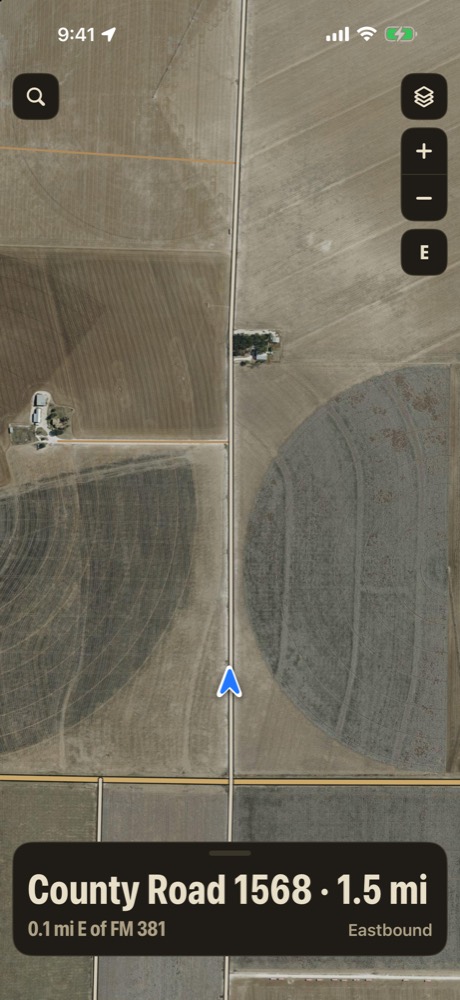
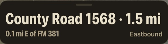
County roads don't have mile markers, so the app gives you the next best thing: how far you are from the highway, and that highway's marker.
- On a county road, the miles back to the highway it meets, with that highway's mile marker
- Mile marker to the tenth, and the road ahead and behind you on the card
- Copy your location in one tap and text it to the driver
- Paste coordinates in any format, or a map link, and the app finds the spot
"CR 101, 2.5 miles north of the highway at mile marker 458. Gate 4 is on the left."
The roads other maps skip.
Out where the pavement ends, the map keeps going, and so do your directions.
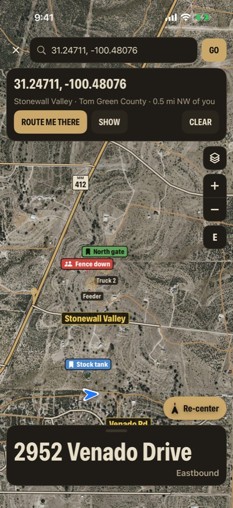
- Private roads and ranch tracks drawn on the map, from U.S. Census map data
- Route me there works with no signal, all the way onto lease and ranch roads
- Out past the pavement, the banner reminds you to check gates
- Every county road labeled like its sign
Many lease roads and ranch tracks are private. Get permission before you drive one.
Know whose surface you're on.
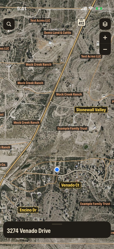
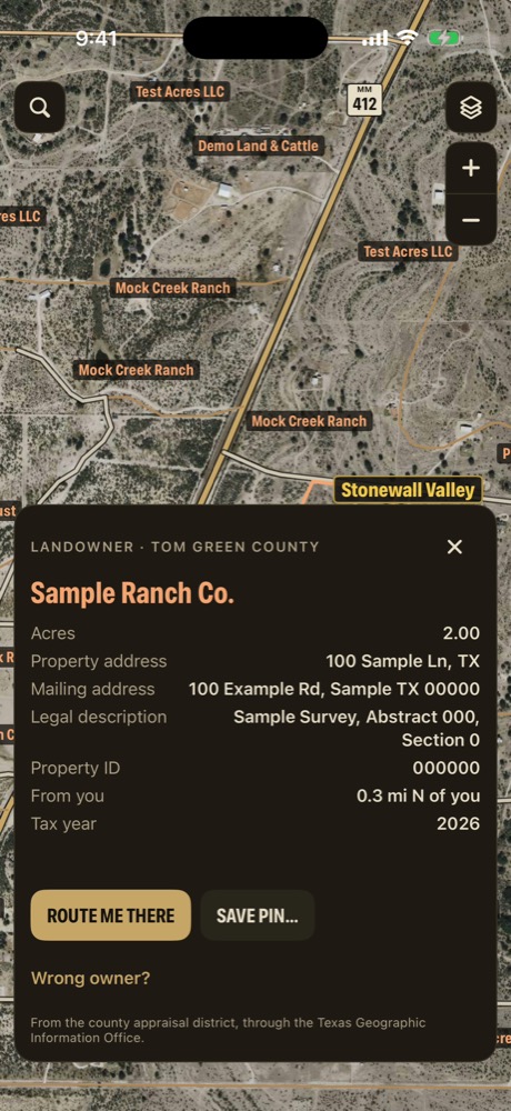
Tap a tract for what the county has on record, so you know who to call about a gate, a fence or a cattle guard.
- Surface owner on record, acres and mailing address
- Legal description, property ID and tax year
- From public county appraisal records, across Texas
- Owner names can print right across the land
Appraisal records show the surface owner. Mineral and lease interests are often held separately and aren't shown. Outlines are approximate and aren't a survey.
Every location keeps its own file.
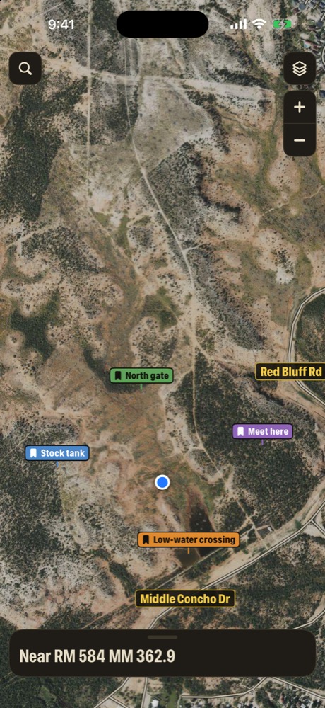
Gate 4. The bad cattle guard. The low spot that holds water after a rain. Drop a pin and keep its whole story in one place.
- A contact person and address at the top of the file
- Dated, time-stamped entries with photos and documents
- Entries can't be edited, only deleted, so the record stays straight
- Share it with your crew and everyone adds to the same file, each entry signed with its writer's name
- Encrypted on the phone with your group code before it goes to iCloud
Every truck, on one map.
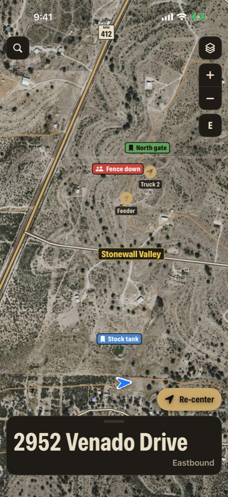
Spread across three leases and two counties, your crew shows up on the same map.
- Join with a share code, and pick the name your crew sees, like Truck 2
- Send a location to one driver, or to the whole crew
- Trucks show only while Share my location is on, with no location history
- Breadcrumb trail: record the way in and share it as a GPX file
And the rest of it.
Every copy of Mile Marker TX has these too.
Works with no signal
Markers, addresses, landowners, the offline map and offline routes.
Night mode
Dims the map and turns the card red after sunset.
Driving mode
Your road and mile marker on the lock screen and Dynamic Island.
Turn alerts, no voice
A quiet alert before each turn and a tap on Apple Watch.
12.1 million 911 addresses
Give 911 a real address when something goes wrong.
Does it show mineral owners?
No. It shows the surface owner from public county appraisal records. Mineral and lease interests are often held separately and aren't shown.
Are lease roads open to drive?
Many lease roads and ranch tracks are private. The map shows them so you can find your way, not as permission to use them. Get permission first.
Does it work with no signal?
Mile marker readings, 911 addresses, landowners, the offline map and offline routes all work with no signal. Satellite view and crew updates need signal.
Who can see my crew?
Only phones that enter the same share code, and only while each person has Share my location on. There's no location history, and positions older than 15 minutes are hidden.
Is this affiliated with the Railroad Commission or TxDOT?
No. Mile Marker TX is made by Redstone Oak Investments LLC, a Texas company, and isn't affiliated with or endorsed by any government agency.
What does it cost?
Mile Marker TX is free to download.